Bora Bora · Climate
Bora Bora
weather.
Thirty years of readings from the airport on Motu Mute: what the temperature, the rain, the sea and the wind actually do, month by month.
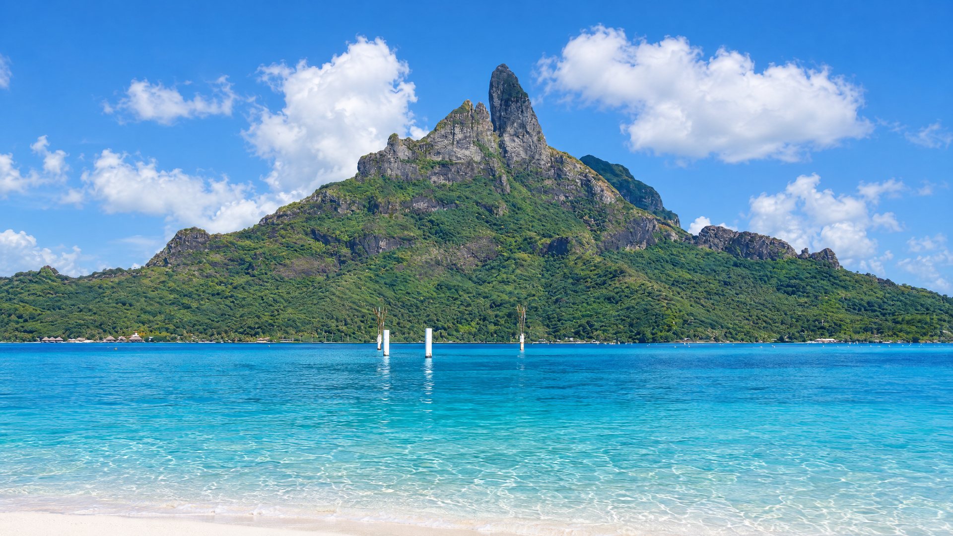
Otemanu from the outer motu
Bora Bora is hot all year and wet for half of it. Météo-France's station at the airport, on the flat islet of Motu Mute, averages 27.6 °C over the year and 1,654 mm of rain, most of it between November and April1. The mean daily high moves only 2.5 degrees between March and July. What changes is the rain, the wind and, in some years, the chance of a cyclone.
01 · Two seasons
Two seasons,
one thermometer.
Météo-France Polynésie describes two seasons in the Society Islands: a warm, more humid one from November to April, and a cooler, less humid one from May to October, with December and January the wettest months2. At Bora Bora the split is sharp in the rain gauge and soft on the thermometer.
December, the wettest month, averages 250.7 mm; July, the driest, 61.9 mm, a quarter as much1. Mean highs run from 31.4 °C in March to 28.9 °C in July, and the nights barely move: the mean low stays between 23.9 and 25.8 °C all year1. In the 1991–2020 normals the station never recorded a day with a high of 20 °C or less1.
All of this comes from one station, 3 m above sea level on the airport motu1. Météo-France notes that in the Society Islands the coasts exposed to the trade wind, and above all the heights, are much wetter2, so the island's slopes, Otemanu's included, can be wetter than these airport figures. The motu resorts sit at the same low level as the station.
02 · The year in numbers
The year
in numbers.
- Mean temperature
- 27.6 °C (81.7 °F) over the year1Monthly means from 26.4 °C (August) to 28.6 °C (March)
- Mean high / low
- 30.2 °C / 24.9 °C (86.4 °F / 76.8 °F)1
- Rain
- 1,654 mm a year (65 in)161.9 mm in July, 250.7 mm in December
- Rain days
- 147 days a year with at least 1 mm18.8 in August, 17.2 in January
- Hot days
- 210 days a year reach 30 °C127.5 in March, 3.8 in July
- Record high
- 35.9 °C, 11 November 19961Temperature records since 1976
- Record low
- 17.8 °C, 10 July 19831
- Wettest day
- 435.5 mm on 24 November 19831More than a quarter of a normal year in one day
- Wind
- 5.1 m/s (18 km/h, 10 knots), mean over 10 minutes1Strongest in July and September, 5.7 m/s
- Strongest gust
- 40 m/s (144 km/h), in March 1983 and April 19981Gust records since 1981
- Sea
- 26.9 °C (August–September) to 29.1 °C (March–April)3Monthly averages over ten years
03 · Season against season
Warm season,
cool season.
- Mean lows
- Warm season (Nov–Apr): 25.0–25.8 °C
Cool season (May–Oct): 23.9–25.2 °C - Rain
- Warm season (Nov–Apr): 1,158 mm over six months, 70% of the year1
Cool season (May–Oct): 496 mm over six months1 - Rain days (1 mm or more)
- Warm season (Nov–Apr): 88 in six months
Cool season (May–Oct): 59 in six months - Days of 50 mm or more
- Warm season (Nov–Apr): 4.3 a season on average
Cool season (May–Oct): 1.3 a season - Days reaching 30 °C
- Warm season (Nov–Apr): 147
Cool season (May–Oct): 62 - Mean wind
- Warm season (Nov–Apr): 4.5–5.0 m/s (16–18 km/h)
Cool season (May–Oct): 5.0–5.7 m/s (18–21 km/h) - Cyclones
- Warm season (Nov–Apr): The season: November to April, sometimes May4
Cool season (May–Oct): Outside it
Verdict. The thermometer barely notices the change of season; the rain gauge, the wind and the cyclone calendar do. Seven of every ten millimetres of the year's rain fall between November and April1.
04 · Month by month
Month
by month.
Air temperatures, rain and wind are Météo-France's 1991–2020 normals for the airport station; rain days are days with at least 1 mm1. Sea temperatures are ten-year averages of satellite and in-situ data3.
January
Hot, wet, heavy showers
Highs 31.1 °C, lows 25.3 °C. 245 mm of rain over 17.2 days, the most rain days of the year, including 0.9 days with 50 mm or more in an average January1. Sea 28.6 °C3. Light wind, 4.8 m/s1.
February
Wet and still
Highs 31.1 °C, lows 25.4 °C. 211.5 mm over 15.3 days; the wettest February day on record brought 213.6 mm, in 19781. Sea 28.8 °C3. Wind 4.9 m/s; the month's strongest gust, 29.2 m/s (105 km/h), came on 3 February 2010 with cyclone Oli15.
March
The hottest month
Highs 31.4 °C, lows 25.8 °C, and 27.5 days reaching 30 °C1. Rain eases to 168.1 mm over 14.5 days. Sea 29.1 °C, the warmest of the year with April3. The joint-strongest gust on record, 40 m/s (144 km/h), blew on 11 March 19831.
April
Warm sea, fewer rain days
Highs 31.1 °C, lows 25.8 °C. 143.9 mm over 11.8 days, though 15 April 1987 alone brought 385.7 mm1. Sea 29.1 °C3. The lightest wind of the year, 4.5 m/s on average, and the other 40 m/s gust, on 25 April 19981.
May
Turning drier
Highs 30.2 °C, lows 25.2 °C. Rain drops to 112 mm over 11.4 days and hot days to 20.41. Sea 28.7 °C3. The trade wind picks up to 5.0 m/s1. The first month of Météo-France's cooler, less humid season2.
June
Cooler and breezier
Highs 29.3 °C, lows 24.5 °C; only 8.9 days reach 30 °C1. 85.5 mm over 9.7 days, with 0.3 days of 50 mm or more: a dry month, not a rainless one1. Sea 28.0 °C3. Wind 5.4 m/s1.
July
Driest and coolest
The driest month, 61.9 mm over 9.4 days, and the coolest by day: highs 28.9 °C, lows 24.1 °C, 3.8 days at 30 °C1. Sea 27.3 °C3. Joint windiest month, 5.7 m/s (20 km/h). The station's all-time low, 17.8 °C, came on 10 July 19831.
August
Dry, breezy, coolest nights
Highs 29.0 °C, lows 23.9 °C, the lowest of the year1. 63.7 mm over 8.8 days, the fewest rain days. Sea 26.9 °C, the year's lowest with September3. Wind 5.6 m/s; a 30.4 m/s gust (109 km/h) on 31 August 2009 is the cool season's strongest1.
September
Dry and windy
Highs 29.4 °C, lows 24.0 °C. 64.6 mm over 9.3 days; a 50 mm day is rare, though 136.6 mm fell on 22 September 20231. Sea 26.9 °C3. Wind 5.7 m/s, joint windiest1.
October
Warming, rain returning
Highs 29.9 °C, lows 24.5 °C, with 15.9 days at 30 °C1. Rain climbs to 108.7 mm over 10.6 days. Sea 27.2 °C3. Wind 5.4 m/s. The calmest month for gusts: its record is 21.4 m/s (77 km/h), from 20211.
05 · Rain
How the rain
actually falls.
Monthly totals hide the pattern. December's 250.7 mm falls over 16.8 rain days, about 15 mm a rain day, and an average December has 1.1 days of 50 mm or more1. Tahiti Tourisme describes wet-season showers as generally brief, followed by sun6; the numbers bear out the heavy-shower part.
The dry season is drier, not dry. July still has 9.4 days with rain, against 17.2 in January1. What matters for a lagoon tour is how often a whole day is lost: 50 mm days happen about 5.5 times a year at the airport, and all but a fraction of them between October and May1.
The extremes belong to the warm season: the wettest day on record, 435.5 mm on 24 November 1983, and 385.7 mm on 15 April 19871. Météo-France publishes no sunshine record for this station1; Tahiti Tourisme's figure for the islands is 7 hours of sun a day from November to February and 8 from March to October6.
06 · Wind
The trade wind
and the mara'amu.
The wind follows the seasons the other way round from the rain. The 10-minute mean at the airport is 4.5 to 4.9 m/s (16–18 km/h) from December to April and 5.4 to 5.7 m/s (19–21 km/h) from June to October1.
The strong south-east trade wind of the cool season has a name, the mara'amu. On the water it shows as chop across the open stretches of the lagoon, which matters more on a paddleboard or in a small boat than on a resort pontoon. With the year's lowest temperatures, it makes July and August the least sticky months.
Storm gusts are another matter. The station's records, kept since 1981, top out at 40 m/s (144 km/h), on 11 March 1983 and 25 April 1998; outside the November–April season the strongest gust is 30.4 m/s (109 km/h), on 31 August 20091. Météo-France treats wind as dangerous from a 65 km/h mean or 100 km/h gusts inland, thresholds that vary by region7.
07 · The sea
The sea,
27 to 29 °C.
The lagoon never gets cool. Monthly averages run from 26.9 °C in August and September to 29.1 °C in March and April, and the lowest monthly minimum in ten years of data is 25.9 °C, in July and September3. When we checked, these figures agreed within half a degree with WeatherSpark's8.
Most snorkelers swim without a wetsuit in any month; a rash vest is about sun and coral as much as warmth. The cool-season months bring the humpback whales: the environment directorate's leaflet puts them around the islands from July to the end of October, in winter water of 21 to 27 °C across the territory9.
08 · Against Tahiti
Bora Bora
or Tahiti weather?
- Wettest month
- Bora Bora (airport): December, 250.7 mm
Tahiti (Faa'a airport): December, 279 mm - Driest month
- Bora Bora (airport): July, 61.9 mm
Tahiti (Faa'a airport): August, 41 mm - January high / low
- Bora Bora (airport): 31.1 / 25.3 °C
Tahiti (Faa'a airport): 31.0 / 24.4 °C - July high / low
- Bora Bora (airport): 28.9 / 24.1 °C
Tahiti (Faa'a airport): 29.2 / 22.1 °C
Verdict. Near enough the same climate: Bora Bora's cool season is a little wetter than Faa'a's and its nights are two degrees warmer. Both are sea-level airport stations; windward coasts and heights are much wetter2, and Moorea's north-west coast at Papetoai gets about 2,690 mm a year11.
09 · Cyclones
Cyclones:
rare, not hypothetical.
In the southern hemisphere the cyclone season runs from November to April, sometimes into May4. Destructive storms used to be rare in French Polynesia: national meteorological archives counted fourteen between 1831 and 198212.
Then came 1982–83, when six cyclones struck the territory in five months, in a season of unusually warm water that a French Senate report traced to a wider imbalance in the tropical Pacific12. Since then the Leeward Islands, Bora Bora included, have been hit in 1997, 1998 and 201013145.
The airport's own record shows the pattern: its four strongest gusts all fell between December and April1. Many seasons pass with no storm near the island. When one does come, Météo-France Polynésie runs the cyclone alert and its map at meteo.pf15.
10 · History
Four seasons
the island remembers.
- 01
- 02
November 1997: Osea
Less than a month after cyclone Martin, the tropical storm Osea struck the Society Islands, Maupiti and Bora Bora above all, in the words of the French president's message of 27 November 199713.
- 03
- 04
February 2010: Oli
Oli tracked from near Mopelia towards Tubuai between 3 and 5 February 2010. Météo-France recorded sustained winds of 73 km/h and gusts of 105 km/h at Bora Bora; houses and some hotels on Bora Bora, Raiatea, Taha'a, Maupiti and Huahine were destroyed or damaged by wind and waves5.
Forecasts and warnings
We don't publish forecasts. Météo-France Polynésie does, along with a vigilance map for heavy rain, storms, waves and strong wind, and the cyclone alert map15: meteo.pf. For which month suits your trip, and how to hedge a wet-season booking, see the best time to visit; for the whole country's seasons, when to go.
11 · Questions
Questions.
- 01
What is the weather like in Bora Bora?
Hot and humid all year: mean highs of 28.9–31.4 °C and lows of 23.9–25.8 °C at the airport station. The seasons differ in rain: about 62–65 mm a month from July to September, 245–251 mm in December and January1.
- 02
- 03
How warm is the sea?
As monthly averages, 26.9 °C at its coolest in August and September and 29.1 °C at its warmest in March and April3.
- 04
- 05
Is Bora Bora windy?
Moderately. The mean wind at the airport is 5.1 m/s (18 km/h), strongest in July and September at 5.7 m/s and lightest in April at 4.5 m/s1.
- 06
What is the coolest month?
July by day (mean high 28.9 °C) and August by night (mean low 23.9 °C). The record low is 17.8 °C, on 10 July 19831.
- 07
Does it rain every day in the wet season?
No. January, the month with the most rain days, averages 17.2 days with at least 1 mm, so roughly every other day stays dry at the airport; much of the rain comes in heavy showers1.
- 08
- 09
What is the hottest it gets?
The station's record is 35.9 °C, on 11 November 1996. Days of 35 °C or more average 0.3 a year1.
- 10
Where can I get a forecast?
From Météo-France Polynésie at meteo.pf, which also publishes the vigilance and cyclone alert maps15.
Sources · last verified 19 October 2026(15)
- Météo-France: Fiche climatologique — Bora-Bora-Motu-Aero (98714002, alt. 3 m), statistiques 1991–2020; temperature and rain records 1976–2025, gust records 1981–2025 ↗
- Météo-France Polynésie: Climat de la Polynésie (seasons; Society Islands: wettest months, windward coasts and heights) ↗
- seatemperature.info: Bora Bora water temperature — monthly averages, minimums and maximums, 10 years of satellite and in-situ data ↗
- Météo-France Polynésie: Qu'est-ce qu'un cyclone ? (southern-hemisphere season: November to April, sometimes May) ↗
- NIWA: TC Oli in French Polynesia (Sébastien Hugony, Météo-France), Island Climate Update 119, August 2010 ↗
- Tahiti Tourisme: When to visit The Islands of Tahiti (seasons, sunshine hours, high and low season) ↗
- Météo-France Polynésie: Dangers météorologiques — vent violent (65 km/h mean, 100 km/h gusts inland) ↗
- WeatherSpark: Average weather in Bora-Bora year round — water temperature (cross-check for sea temperatures) ↗
- Direction de l'environnement (DIREN), Polynésie française: Comment observer les mammifères marins en Polynésie française (humpbacks July–end October; permits around nine islands incl. Bora Bora, 20 July–20 November; May 2025) ↗
- Météo-France: Fiche climatologique — Faaa (98715002), statistiques 1991–2020 et records (edited 6 June 2025) ↗
- Météo-France: Fiche climatologique — Papetoai 4 (98729010), Moorea, statistiques établies sur la période 1993–2020 ↗
- Sénat: Rapport n° 352 (1982–1983) sur la proposition de loi tendant à organiser une souscription nationale en faveur de la Polynésie française (six cyclones, December 1982–April 1983; fourteen destructive cyclones 1831–1982) ↗
- Présidence de la République: Message de Jacques Chirac aux habitants de la Polynésie française après le passage du cyclone Osea (27 November 1997) ↗
- Wikipedia: Cyclone Alan (April 1998; citing Fiji Meteorological Service summaries and press reports) ↗
- Météo-France Polynésie: Prévisions, vigilance (fortes pluies, orages, vagues-submersion, vent violent) and cyclone alert ↗